
Basalt Plateau and Vent Morphology
The Smithsonian Global Volcanism Program describes the field as a broad central plateau built from successive basalt flows and scoria deposits. A 2016 volcano-tectonic mapping study published in the Journal of Volcanology and Geothermal Research catalogued 432 lava shields and pyroclastic cones alongside 47 fissures and feeders distributed across the province.
Eruption Phases and K–Ar Age Record
K–Ar dates compiled by the Smithsonian range from about six million to 400,000 years, indicating that dated lava samples record separate eruptive phases rather than a single continuous episode. Petrological research on the southern portion, Al Haruj al Abyad, identifies multiphase alkaline basalts that record distinct pulses of intraplate magmatic activity.
Landsat Imagery and the Balta Landforms
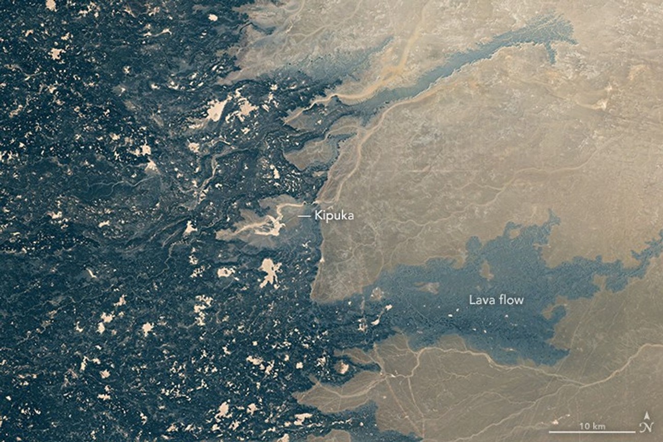
A NASA Landsat 8 mosaic of the field, compiled between 2013 and 2016, reveals the volcanic terrain at regional scale. The eastern detail shows patches of sand alongside some depressions termed balta, the locally used term for older ground entirely surrounded by younger lava flows, a pattern that makes the sequencing of eruptive phases legible across the plateau surface.